|
After a week of sitting in cars and working indoors, we desparately needed some open space. We decided to pay a visit to Allt Lwyd. It is one of three summits we need to reach before we complete all the Hewitts in the Central Beacons. The forecast was for a day of sunshine - not a common occurence in Wales, especially in November. However, clear skies meant low temperatures and when we parked up alongside the Talybont Reservoir it was -3˚C. We were greeted by a friendly robin who begged some food from us. We were happy to oblige. We headed up the well-marked path, frosty grass crunching underfoot. We were careful to avoid the thick patches of ice, which on a warmer day would have been muddy puddles. The ascent was steep and, despite the cold, we soon had to remove some layers. We reached the summit of Allt Lwyd fairly quickly. The view was superb. In the east, the upper slopes of Black Mountains looked like a Vienetta ice-cream due to alternate bands of rock and snow. Even from a distance, Langorse Lake looked frozen. We continued along the col and encountered more residual snow. We chose to extend our walk around the summit of Waun Rydd...along the ridges we missed last time! There were some fantastic icicles hanging from the peat haggs. We had our lunch next to the cairn at the junction of Gwalciau'r Cwm and Cwar Y Gigfran. There were large patches of frozen snow, which crunched underfoot as they began to freeze when the afternoon temperature began to drop rapidly. We eventually summited Waun Rydd and enjoyed the spectacular 360 degree view, which we had missed last month due to low cloud and rain. The obvious path to Carn Pica was now quite treacherous as some of the earlier snow-melt had frozen in glassy sheets - it looks like crampons could be an upcoming purchase! As the sun began to set, we made a relatively rapid descent of the Twyn Du ridge. This time we were thankful for the sub-zero temperatures which had frozen the usual quagmires into ground with a firm, crusty surface. In spite of the cold, we walked down to the edge of the reservoir to take some photos of a beautiful sunset. We were not alone. The cheeky robin reappeared...and we were able to reward him with a few crumbs before heading for home. Learned and Affirmed
0 Comments
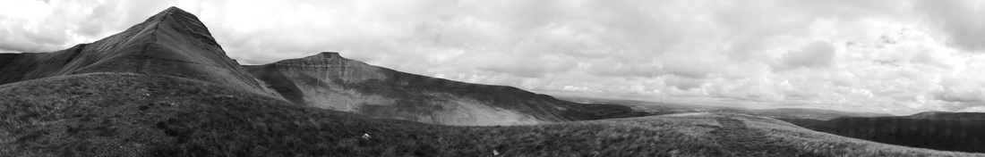
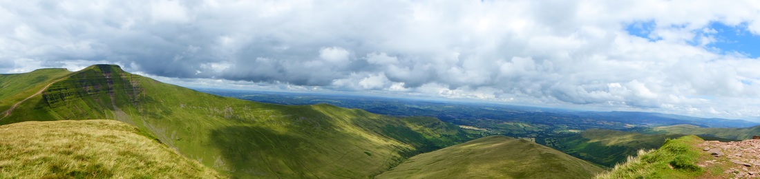
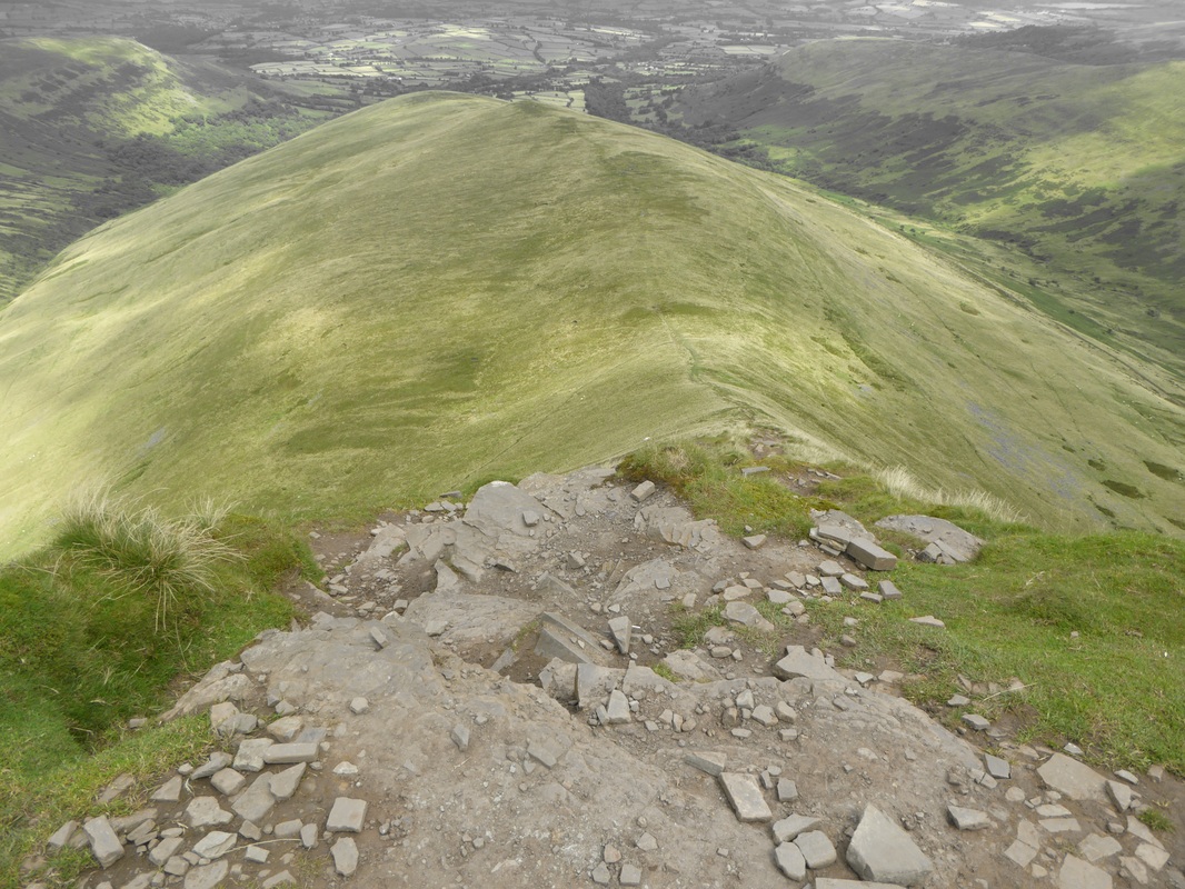
This week (in September) we were fortunate to have flexible working hours, so we could make the most of a good weather forecast, and head to the hills. Our intention was to climb Waun Fach, the highest peak in the Black Mountains at 811 m / 2661 ft, which also makes it the second highest mountain in southern Britain, south of Snowdonia. (The highest being Pen y Fan). This was also the first outing of our new Deuter rucksacks!!! After leaving the pub car park in Pengenffordd (there is an 'honesty box' provided by pub - donations to charity) we made the quickly steep ascent to Castell Dinas, the ruins of an old Norman castle, then descended to a col with a small stream at the foot of Y Grib - known by some as the 'Dragon's Back'. When you see it, it is immediately apparent why the ridge bears this name. Glorious sunshine and short dry grass made the climb of the spine very enjoyable. As we made our way up each incline and plateau, the view grew ever more panoramic. By the time we reached a tall conical cairn, we could see the Camarthan Fans, the peaks of Fforest Fawr and summits and ridges of the Central Beacons. As we continued our way to the summit, we a paused to enjoy the antics of some Welsh hill ponies, who also seemed to be making the most of the summer sunshine. When we reached the cairn at Pen y Manllwyn, we had a great view of Hay Bluff and Twmpa (Lord Hereford's Knob) and also the Malvern Hills in the distance. It was so clear that we could also see Brown Clee and the Wrekin in Shropshire. As we had been warned, the summit view itself is slightly disappointing. However, there was much evidence of land conservation work taking place - presumably to stop peat erosion. At the sad remains of a trig point we made the decision to deviate from the recommended route and head along the well-maintained path to the summit of Pen y Gadair Fawr. The extra mile was definitely worth the effort. Great views of the Sugar Loaf, Skirrid, the Blorenge and Abergavenny. We made the return journey to Waun Fach, as the sinking sun created dramatic shadows on the eastern faces of the mountains. The descent was well-marked with awesome views of Crug Mawr, Pen Allt-mawr and Pen Cerrig-calch to the south. On reaching the final cairn at Y Trumau, the sun sank behind Mynydd Troed and cast the valley in shadow. We followed the route back to the car park, knowing that we would return to climb some of the peaks we had view but not yet walked. Working on the weekend was definitely a small price to pay for such a beautiful day! Learned and Affirmed
Way back in February, our friends Maria and Jenni took us on our first trek in the snow in the Pentland Hills. Later in the year they led us up our first two Munros - Ben Vorlich and Stuc a Chroin. Knowing they were making a brief stop in Wales, we planned to take them on a ridge walk in the Beacons. Unfortunately, just prior to their visit, Maria broke her wrist and it was still in plaster when they arrived. However, Maria was still wanted to do a walk, so we decided that the 'tourist route' up to Pen y Fan and Corn Du would be manageable, despite her injury. The weather forecast clouds with sunny intervals, so we headed set off to the Storey Arms, hoping for the best. Being early on a weekday, there was no problem parking and we began along the path, which resembles a red scar across the mountainside. Corn Du was shrouded in mist but Fan Fawr and the Fans were visible. As we were about a third of the way up, we were passed by soldiers carrying full packs and automatic weapons. While they gave nods and smiles of thanks as we made way for them, they were reluctant to engage in conversation - presumably because their every word would be heard on each other's head sets. As we reached the col of Bwlch Duwynt we decided to take the path to Pen y Fan then 'bag' Corn Du on the return. On Pen y Fan summit the mist was thick and the soldiers, crouching in formation, looked quite eerie. We had some group photos at the cairns on both summits but sadly the mist did not clear and we headed back to the car. Annoyingly, just as we were removing our walking boots, the cloud lifted and Corn Du appeared. Resorting to 'Plan B' we drove the the Brecon Beacons Mountain Centre in Libanus and viewed the twin peaks from the comparitive comfort of picnic bench, coffee in hand. Learned and Affirmed
Leaving home later than we had planned, we were very lucky to find a parking place opposite the Storey Arms Outdoor Education Centre. It’s great that so many people are being active but accommodating so many cars is becoming a real issue on the weekends. While the path to Pen y Fan looked like the route to a religious shrine, crammed with hundreds of pilgrims; the route to Fan Fawr was, well…empty…except for the two of us. Phew! As we dropped down from the A470 to the ‘Taff Trail’ path, we followed the Taf Fawr to the point where it enters the Beacons Reservoir. You have to keep your wits about you if you want to avoid the numerous boggy patches through which the path runs. However, once we reached the far end of the reservoir (via moorland and forest tracks) we were glad to begin our ascent of Fan Fawr’s long, curving eastern ridge - Cefn Yr Henriw. As we neared the summit, we spied the trig point off to the west. We decided to visit it although it wasn’t on our walk route. We were glad that we made the detour. Just as we got there, the sun emerged from the overcast sky and we had a great view of previously visited western peaks – Fan Nedd, Fan Gyhirych, Fan Frynych, Fan Hir and Fan Brycheiniog. We then made our way to the ‘true summit’ (734 m/2048 ft), marked by a small cairn. Whilst we had a quick snack, we watched the continuous line of ‘pilgrims’ making their way up the Pen y Fan path, and a couple of paragliders frightening sheep on the other side of the valley. As we made our post-lunch descent, we met another walker with her two dogs, one of whom took a great interest in Lynne! Like us, she was avoiding the crowds. We exchanged a few pleasantries and congratulations (she had just graduated!), then made our way back to the busy car park. Learned and Affirmed
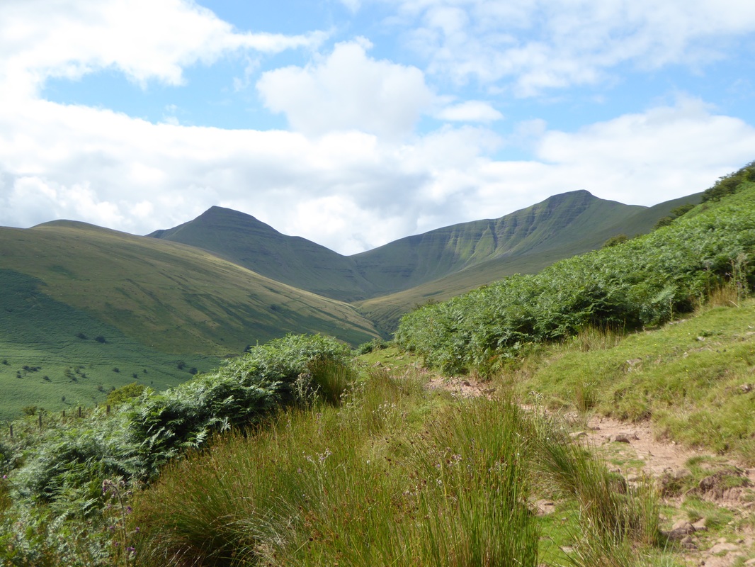
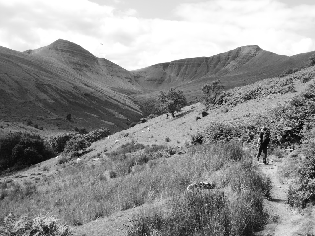
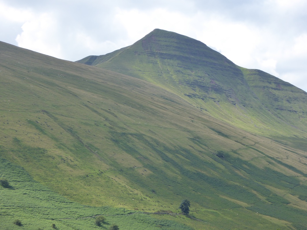
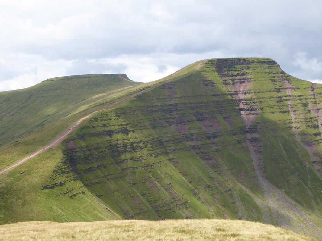
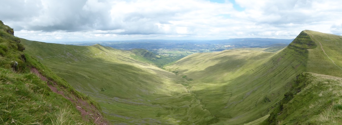
Our initial intention was to complete an 8 mile circuit, with Fan y Big as the only summit involved. However, the sight of Cribyn, Pen y fan and Corn Du was just too much to resist. Looking at the map, we calculated it would probably add another 5 or 6 miles to our original plan, but if we left out Cribyn, it would seem more sensible! Fan y Big, according to wikipedia, "is a subsidiary summit of Waun Rydd in the Brecon Beacons National Park, in southern Powys, Wales. It is 719 m (2,359 ft) high and is often hiked as part of the Horseshoe Walk, a traverse of the four main peaks in the Brecon Beacons." Free parking at the Blaen y Glyn Forestry Car Park - always a welcome start. In the eventual 13 mile circuit, there were only two really strenuous sections. The first was at the beginning. After ascending a well made path along side some beautiful waterfalls, you encounter a long steep gradient to the top of Craig y Fan Ddu. Despite the fact it was a very overcast morning, it was a lot more humid than we had anticipated, so halfway up this climb we had to remove layers and take on water to avoid overheating. Once we had reached the top, we continued on the long ridge walk around the head of three glacial valleys - Cwm Caerfanell, Cwm Cwareli and Cwm Oergwm. The impressive vistas changing every few hundred metres. It is worth remembering to look back every now and again so that you don't miss the spectacular views of where you have been! The scattered peat haggs creating a landscape from a science fiction movie. While Fan y Big itself is a gentle incline, it affords an impressive aligned view of Cribyn, Pen y Fan and Corn Du. There is a small overhanging outcrop of sandstone (allegedly called 'The Diving Board') where, if you have a head for heights, there is a fantastic photo-opportunity. After a quick lunch, we descended Fan y Big and skirted around Cribyn - which, in hindsight, was a wise decision. We made the now familiar ascent of Pen y Fan and Corn Du, then began our trek along the western ridges of the Taf Fechan valley. Different sections of the ridge have different names - Craig Gwaun Taf, Rhiw yr Ysgyfarnog and Graig Fan Ddu. In places, there are sheer drops near the edge of the path. However, if you are anxious about heights, there is lots of grass/heather alongside the well-worn path. We paid a quick visit (due to swarms of flying ants) to the trig point on Twyn Mwyalchod before a tricky descent - the second strenuous section mentioned earlier. A steep, deep cut track with lots of loose stones and slippery surfaces, which, from a distance, looks like a red, bloody scar. Lots of care needed. This is when walking-poles are probably advantageous but as we don't yet possess them, we took our time and selected our route with care. We finally reached the Neuadd Reservoir without injury and after a few photos of the abandoned buildings, we walked bag to the car along two miles of forestry road. We would have enjoyed the sudden appearance of the sun except for the now ubiquitous swarms of flying ants and crane flies. We would have taken some more photos of the waterfalls but at this point we had had our fill of insects and did not want to brave the clouds of midges that we could see around the waters edge...maybe we will return in the snow! Learned and Affirmed:
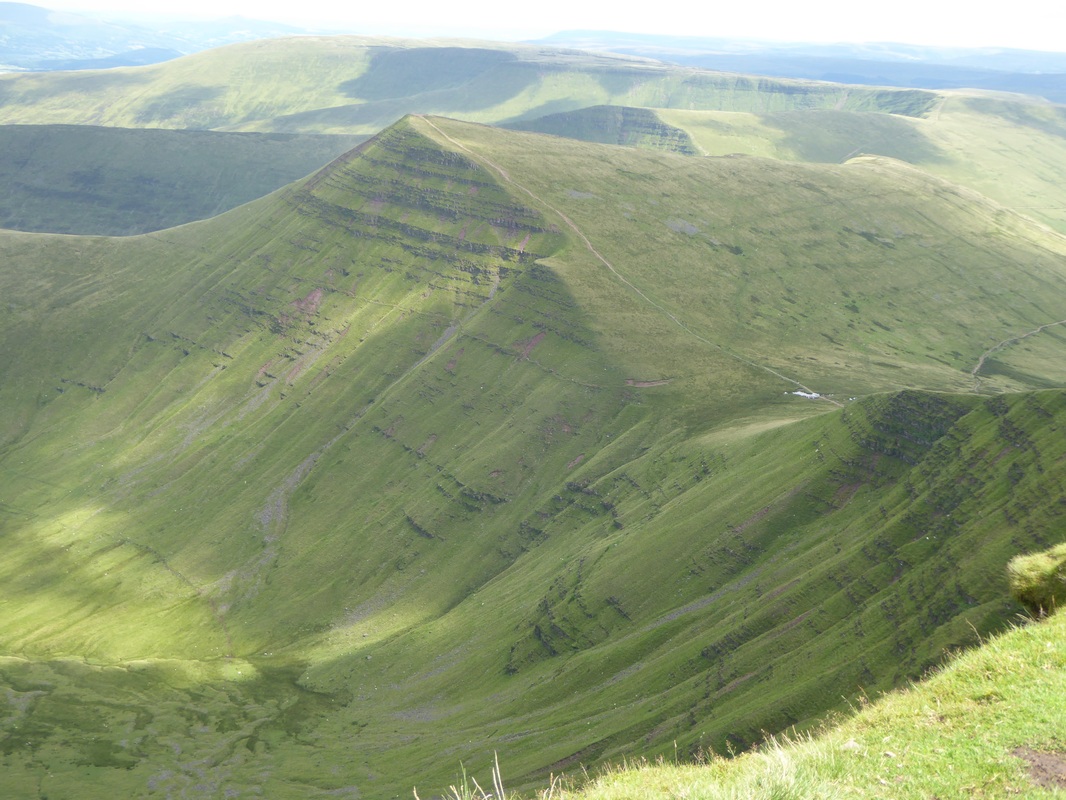
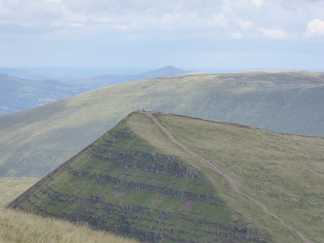
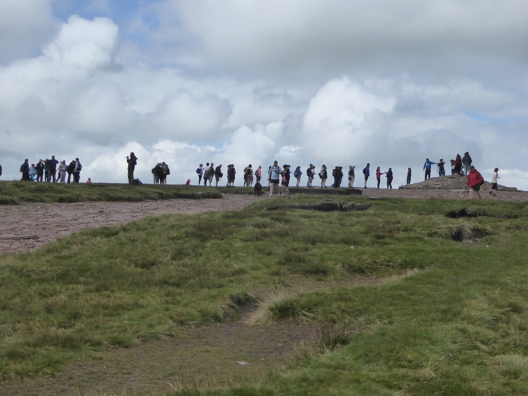
This is a walk we’ve wanted to do for a while and we were waiting for a fine day. Aware that hordes of people walk Pen y Fan on the weekend, we set off early to make sure we had a parking place. We needn’t have worried. Unlike the Storey Arms, the Cwm Gwdi National Trust car park is well off the main route, down a few miles of single-track road. WARNING: The car park is no longer free unless you are a National Trust member. You will need £3 for the new Pay and Display machine. The Cwm Gwdi valley is extremely picturesque but as we emerged from a small wood at the foot of Allt Ddu we hit our first snag…and we had only been walking for 15 minutes. There was no clear path due to the prolific growth of the fern. We circled back to see if we had missed something but ultimately decided to trust the route map and our map reading skills. We had to push through chest high fern in some places but eventually arrived at our exact destination. Phew! As we rounded the base of Allt Ddu the view was superb. The Black Mountain escarpment to our left, while ahead of us was the Cwm Sere valley and the peaks of Cribyn and Pen y Fan. It was an easy and pleasant stroll up the Cwm Sere valley. We received a few noisy complaints as our presence disturbed some newly-shorn sheep and a couple of stonechats but otherwise we marvelled at the spectacular view as the clouds caused the colours to shift on the faces of the two mountains. No other walkers except some tiny figures on the ridges above us. As recommended in our guidebook, we crossed the river above the series of small waterfalls. Once we had hopped across there was no visible path. It was the most strenuous climb of the day. The slippery, spongy tussocks of moss and grass took a heavy toll on thighs and ankles. It was a relief to reach the red, stony path at the top of the ridge. We made the steep ascent to the summit of Cribyn (795 m/2608 ft) - still easier than the grassy slope - to be met with fantastic views of the neighbouring Beacons and their valleys. Llangorse Lake reflected the occasional sunbeams and Brecon town itself. We stayed a few minutes to catch our breath then continued along the well-maintained path up towards Pen y Fan, stopping frequently to take photographs of the ever-changing vistas (and oxygenate muscles!). As we reached the summit, we had been expecting to see plenty of walkers but were somewhat bemused to see the long, orderly queue that had formed for photo-opportunities at the trig point. Very British!? After a well-earned lunch, we made the trek across to Corn Du, then continued down past the Tommy Jones Memorial into the Cwm Llwch valley. It was a fairly relaxing stroll back to the car park although the final incline felt like it was mocking our tired legs. We valued the company of a pair of Grey Wagtails as we made our way along the river path, and tip-toed around a herd of horses shading their foals near a camping area. Learned and Affirmed:
New Learning:
Ordance Survey Explorer maps are more eco-friendly when printed on both sides of the paper. However, do not open and attempt to 'reverse-fold' whilst still in a car! ;-) Recently Lynne has been researching common foot injury issues after experiencing a nagging pain in her heel. Plantar fasciitis or the achilles tendon seem to be the potential causes. Today Lynne tried 'Scholl Orthaheel Gel Pain Reliever' shoe inserts - these definitely reduced the discomfort. New Learning:
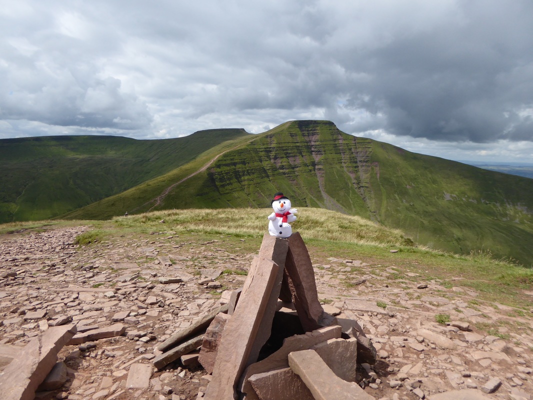
We definitely need to purchase gaiters! Unexpected amounts of snow meant that our feet were wet and uncomfortable. Gaiters may have prevented the snow from getting inside our boots. Either that or the waterproof membrane on our boots has a small tear - this was expertly explained to us by someone who works in Cotswold, Cardiff. New Learning: There seem to be more classifications for hills! These qualify as Nuttalls and Hewitts. If you change your mind about which hill to walk, remember to also change the map in your rucksack! Other hill-walkers seem to like our snowmen friends - they become a talking point and appear in many selfies... Still to discover...
Why is Twmpa known as 'Lord Hereford's Knob'? An internet search did not give any real answers. |
AuthorWe are Lynne and Andrew from Single Steps Learning. Our love of learning and exploring has inspired us to take up 'hill-walking'. We hope to progress from novice to expert! This is our journey. Archives
December 2016
Categories
All
|
 RSS Feed
